
Erection date: 1885
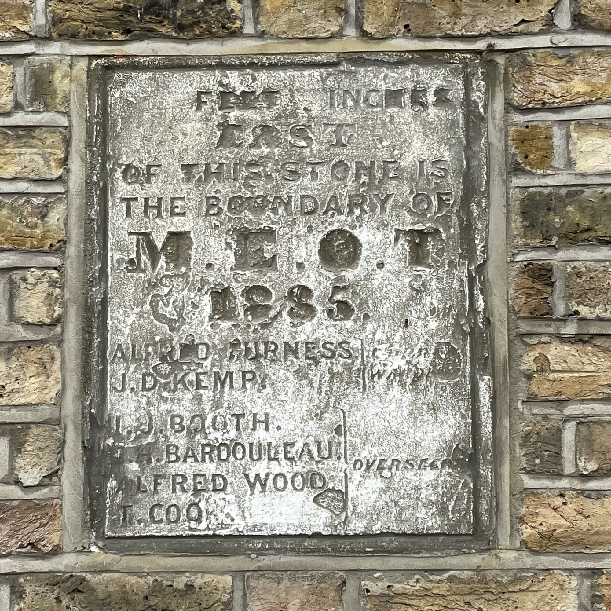
… feet … inches east of this stone is the boundary of M.E.O.T. 1885.
Alfred Furness, J. D. Kemp – church wardens
L. J. Booth, C. H. Bardouleau, Alfred Wood, T. Cook – Overseers
It's odd that the stone seems entirely blank where the feet and inches numbers should be, as if they were never incised.
M.E.O.T. stands for Mile End Old Town.
From the "Overseers were chosen at Vestry meetings to administer the Poor Law for the ensuing year. Under the Poor Law Amendment Act of 1834, Boards of Guardians replaced the Overseers and administration of poor relief left the parish's powers." Which doesn't explain why overseers are being named on an 1885 plaque.
Site: Mile End Old Town boundary marker (1 memorial)
E3, Morgan Street, 20
The plaque is on the Coborn Road side of the Morgan Street house. The back section of the property looks to have been rebuilt (probably larger) than it would have been originally, so we trust the plaque was re-erected in approximately its original location.
We’re always in two minds about collecting boundary markers – are they memorials? Researching this one we came across a “Inventory Of Administrative Boundary Markers In The County Of London Including London Parish Boundary Markers, Part 2 Markers numbered PBM 251 to PBM 500 Compiled by M. A. C Horne FRGS FRSA V3.10 (11 April 2016)” with lots of photos. And .


Comments are provided by Facebook, please ensure you are signed in to see them