Site: Vincent Street fireplace (1 memorial)
SW1, Vincent Street
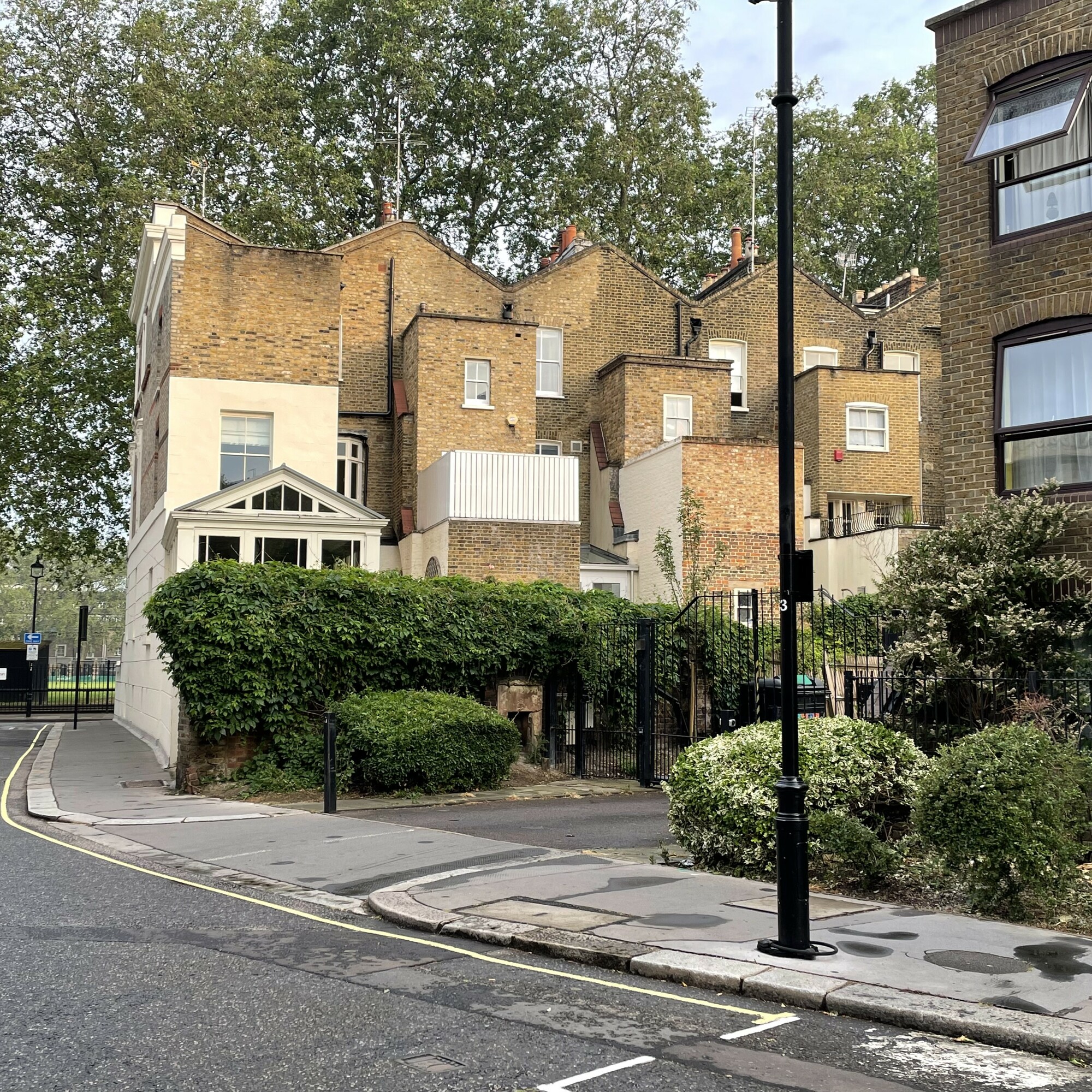
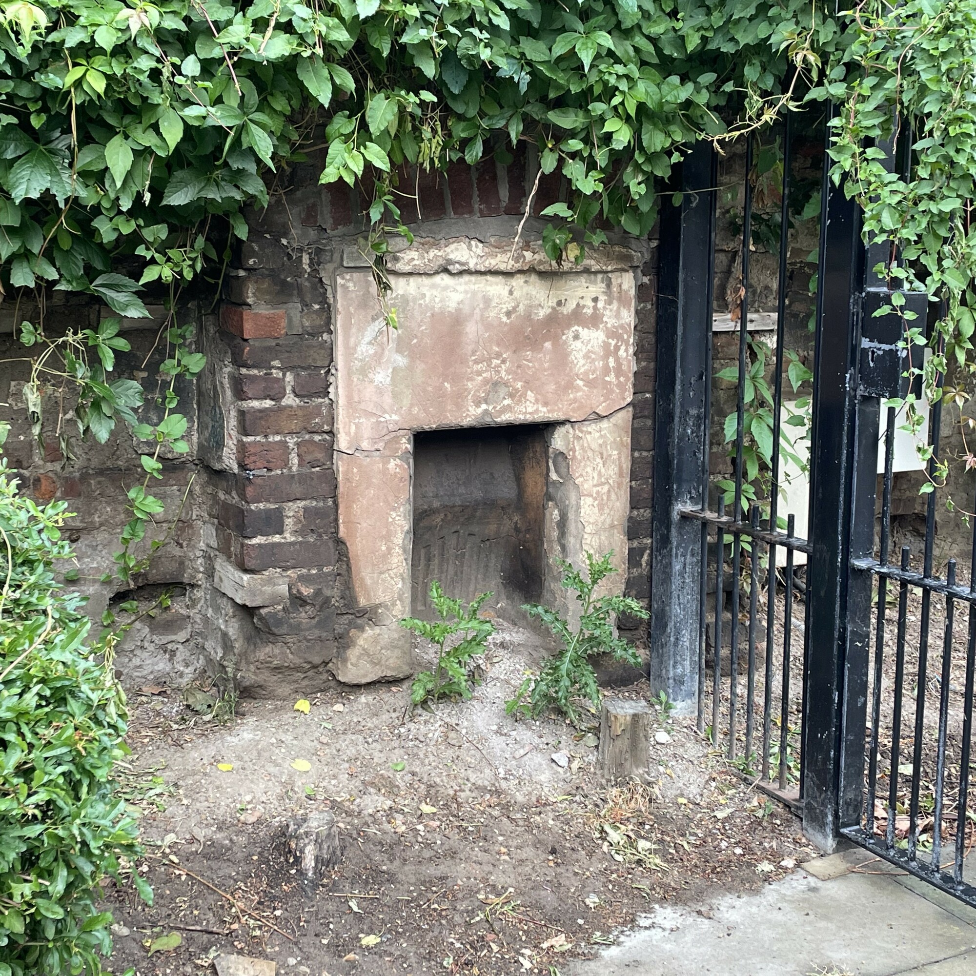
This (top edge, towards the right) shows the house which this fireplace used to warm. Instead of the current access road there was a row of 4 small dwellings (without even back extensions) facing onto the junction with Hide Place, the westmost one having this fireplace in its west wall. Behind a small front garden was the front room with this fireplace.
Going further back in time with this we see that the terrace used to have 5 houses; another house, slightly larger than the 4 already seen on the 1913 map, used to be on the triangle of land to the west of the fireplace. Google Maps suggests that triangle is now subsumed into the plot that makes up 13 Vincent Square (the house and garden backing the fireplace). The 1893 map clearly shows that there was a passage running to the west of the triangle, providing access to what look like very mean dwellings behind the privies of those in Vincent Street. And the map shows that the fifth house was built over the passage.
has all the photos of the fireplace that you could wish for. There we are told that the Blitz destroyed these houses, and many others in Vincent Street. These 4 houses were so much smaller than the others in the area, we bet all the neighbours were glad to see them gone.


Comments are provided by Facebook, please ensure you are signed in to see them