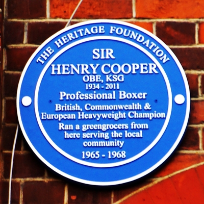
1 subject commemorated,
1 creator
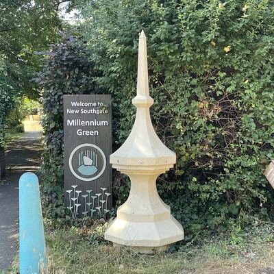
New Southgate gas holder
N11, Inverforth Road, Millennium Green
From nearby information boards we learnt that these are 2 of the 20 finials from the gas holder which used to stand at the junction of St...
1 creator
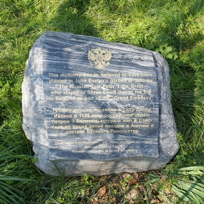
Peter the Great - mulberry tree
SE8, Sayes Court Park
The tree, also known as Evelyn’s Mulberry, was possibly planted by Peter the Great during his four-month stay in the house of John Evelyn...
3 subjects commemorated,
4 creators
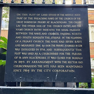
Blackfriars Priory at Church Entry
EC4, Church Entry
The plaque is attached to the railings, you can see it in our photo below the lamp.
2 subjects commemorated
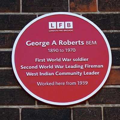
George Arthur Roberts - New Cross
SE14, Queens Road, 266, New Cross fire station
George Roberts was stationed here during WW2.
War served | WW2
1 subject commemorated, 1 creator
1 subject commemorated, 1 creator
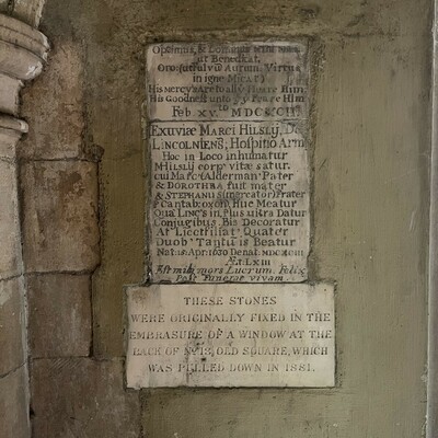
Mark Hilsly burial stone
WC2, Old Square, Chapel undercroft
We are immensely grateful to our Latin consultant, David Hopkins, for his work on these stones: he transcribed and translated them, comme...
1 subject commemorated
1 subject commemorated,
1 creator
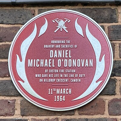
Daniel O’Donovan
N7, Hilldrop Lane, Moelwyn Hughes Court
The front of the building is on Hilldrop Lane but the plaque is at the back, best accessed via Hilldrop Crescent.
1 subject commemorated,
1 creator
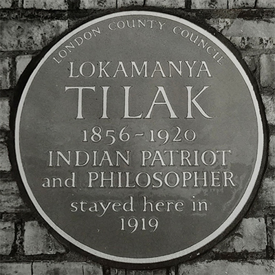
Lokamanya Tilak - Talbot Road
W2, Bayswater, Talbot Road, 60
Unveiled by Kwame Nkrumah. The image of the LCC plaque, taken by the Greater London Council Photographic Unit, Architecture and Civil De...
1 subject commemorated,
2 creators
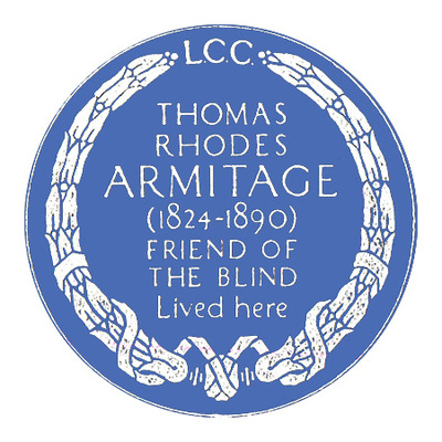
Thomas Rhodes Armitage - W2
W2, Hyde Park Estate, Cambridge Square, 33
Based on a Georgian model grid pattern, the Hyde Park Estate was initially developed in the early 19th Century. It belonged to the Bishop...
1 subject commemorated,
1 creator
 8,114 more memorials