
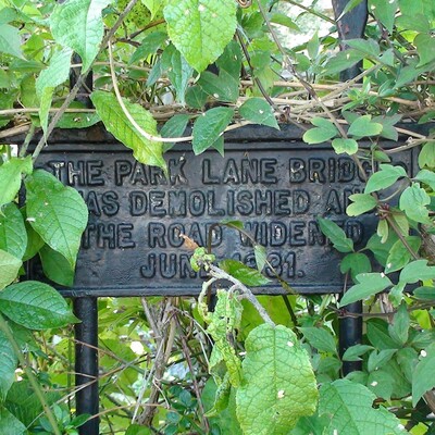
have a good copy of this old postcard and has "Park Lane was renamed Clissold Crescent. The bridge was demolished in 1931 when the road was widened." have the same image and dates it to 1905.
Looking at maps dated , , , and , it's only the last one which shows any significant change, with the river culverted and the road widened, which would tally with the demolition of the bridge in 1931.
has another, tinted, photo of the bridge showing a diamond-shaped plaque on a post. This is, tantalizingly, not quite possible to read - maybe it's warning of the penalties for entering the water.


Comments are provided by Facebook, please ensure you are signed in to see them